Ranchita,
California 92066
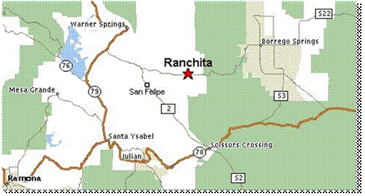
Ranchita
is located between Warner Springs and Borrego Springs, California, at an
elevation of about 4000 feet, snowing off and on from Thanksgiving to Easter.
Current annual rainfall is around 10 inches. Although it is only 13 miles from
Borrego, temperatures are generally 20 or more degrees cooler. Ranchita land
and homes are known for their relative ‘bargain’ prices in comparison to other
parts of San Diego County. The community has a fire station, a community
center, a small store, and curio shop. About 200 people live in the area. Our
skies are clear and sheltered from surrounding light by natural terrain. A
‘mini’ continental divide runs through Ranchita, with half the runoff going to
Baja, and the other half toward the Pacific Ocean. Ranchita is surrounded by
public land such as Anza Borrego State park, BLM and Vista Irrigation water
shed. Most properties are 5 to 10 acres. There is only one public road, and
the rest are all dirt. There are many different bird and animal species. The
center of town is marked by “Rancheti”, an 11 foot tall yeti statue, the towns
unofficial mascot.
Return to home page